Upper Red Lake, Minnesota
Red Lake Fishing Guide: Shallow Water, Strong Walleye Numbers, and Essential Boundaries
This Red Lake Fishing Guide brings together verified lake facts, every DNR-listed fish species, seasonal context, public access information, map resources, and practical trip-planning insight for anglers.
Upper Red Lake is a 119,294.35-acre Beltrami County lake near Waskish with a maximum depth of only 15 feet and a mean depth of 12 feet. Its enormous shallow basin creates a fishery driven by subtle bottom changes, water color, wind, pressure, forage, and long travel distances rather than dramatic contour lines.
The Minnesota DNR narrative describes roughly 60 percent of the lake under Red Lake Band jurisdiction and 40 percent under Minnesota jurisdiction. That boundary is fundamental. Anglers must understand where they may legally travel and fish before leaving shore.
The July 2025 large-lake survey reported 50.9 walleye per gill net, with the 2022 year class dominating the population. The same report described strong northern pike size potential and improving opportunities for larger yellow perch and occasional black crappie.
How to Use This Red Lake Fishing Guide
Upper Red Lake is shallow, but it is not simple. First, identify the legal Minnesota fishing area and access route. Then compare subtle depth, bottom composition, water color, wind direction, and nearby forage inside that boundary.
Meanwhile, walleye regulations are adjusted frequently under cooperative management. A strong survey catch does not remove the need to check the current season, possession rules, and exact water segment before keeping fish.
Northern pike add a trophy component that can connect to shoreline influence, remaining vegetation, river mouths, and open basin forage. Yellow perch and crappie provide additional opportunities, although their location may change quickly in this broad shallow environment.
Most importantly, weather and distance deserve conservative planning. A small wind change can affect miles of open water, and few dramatic contours exist to provide shelter.
Reading Red Lake Structure
On Upper Red, a one- or two-foot depth change can be meaningful. Mud-to-sand transitions, pressure edges, current influence, shoreline proximity, and water color may provide more useful information than a classic sharp drop.
Because the basin is shallow and expansive, wind can alter turbidity, boat control, and fish activity across an entire region. Build a route that can move with conditions without crossing into restricted water.
Finally, LakeFinder did not offer an official Upper Red Lake contour PDF in the collected record. The map section below uses an original conceptual basin profile and links to a live interactive chart without copying restricted tribal or commercial mapping. Use current navigation tools, official boundary information, and local access guidance.
Find the lake
Red Lake Location
Upper Red Lake is in Beltrami County near Waskish, Minnesota. This embedded Red Lake map uses the center coordinates in the DNR record so visitors can review surrounding roads before choosing an access.
Lake center: 48.133428, -94.775326
Use this Red Lake map location for trip planning, then confirm the exact launch before towing to the lake.
The fishery
Red Lake Fishing Guide: Species and Survey Context
Upper Red Lake has 15 fish species in the Minnesota DNR record. The four cards cover the headline fishery, and the complete guide adds the native open-water and bottom-oriented species that help explain this shallow lake’s food web.
High-catch fishery
Walleye
In July 2025, the DNR survey recorded 50.9 walleye per gill net, with young fish from the 2022 year class dominating the catch.
Trophy potential
Northern Pike
Meanwhile, the same large-lake report described strong size potential for pike in Upper Red Lake.
Improving opportunity
Yellow Perch
In addition, the DNR reported improving chances for larger perch as the population and forage picture changed.
Occasional bonus fish
Black Crappie
Crappie remain part of the fish community and can provide memorable bonus opportunities when schools are located.
Interactive species guide
Meet the Fish of Upper Red Lake
Upper Red Lake has little dramatic relief, so fish location often turns on wind, water color, subtle bottom change, forage, and river influence. Choose a species to see how it fits this shallow system and what the DNR record does or does not quantify.
15DNR-listed species
Walleye selected.
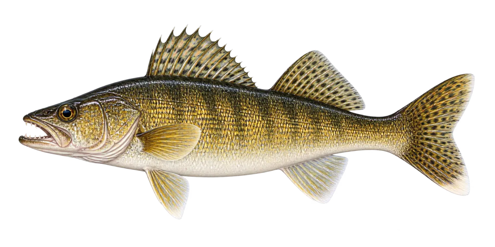 White lower tail tip and reflective eye
Classic target
Walleye
Sander vitreus
- Spring
- Summer
- Fall
- Winter
In particular, consider Walleye in Upper Red Lake’s enormous 15-foot-deep basin. Within Red Lake, walleye are built for low-light feeding. Across Red Lake, wind, cloud cover, dawn, dusk, water color, and access to depth can all affect their position.
How to recognize it
For example, use these marks for an Upper Red Lake field check. On Red Lake, a large glassy eye and bright white lower tip of the tail are the easiest field marks. Around Red Lake, the mouth has noticeable canine teeth.
Red Lake survey snapshot
The July 2025 large-lake survey recorded 50.9 walleye per gill net, with fish from the 2022 year class dominating the population.
Where it fits here
Meanwhile, in Upper Red Lake, small depth changes, bottom transitions, water color, and wind can organize fish across miles of otherwise similar water.
Often confused with
By contrast, compare these marks before assigning an Upper Red Lake species name. On Red Lake, sauger have rows of black spots on the dorsal fin and lack the walleye’s clear white lower tail tip.
Starting depth zone
Low-light shallows through deeper structureDepth changes with light, wind, forage, and season.
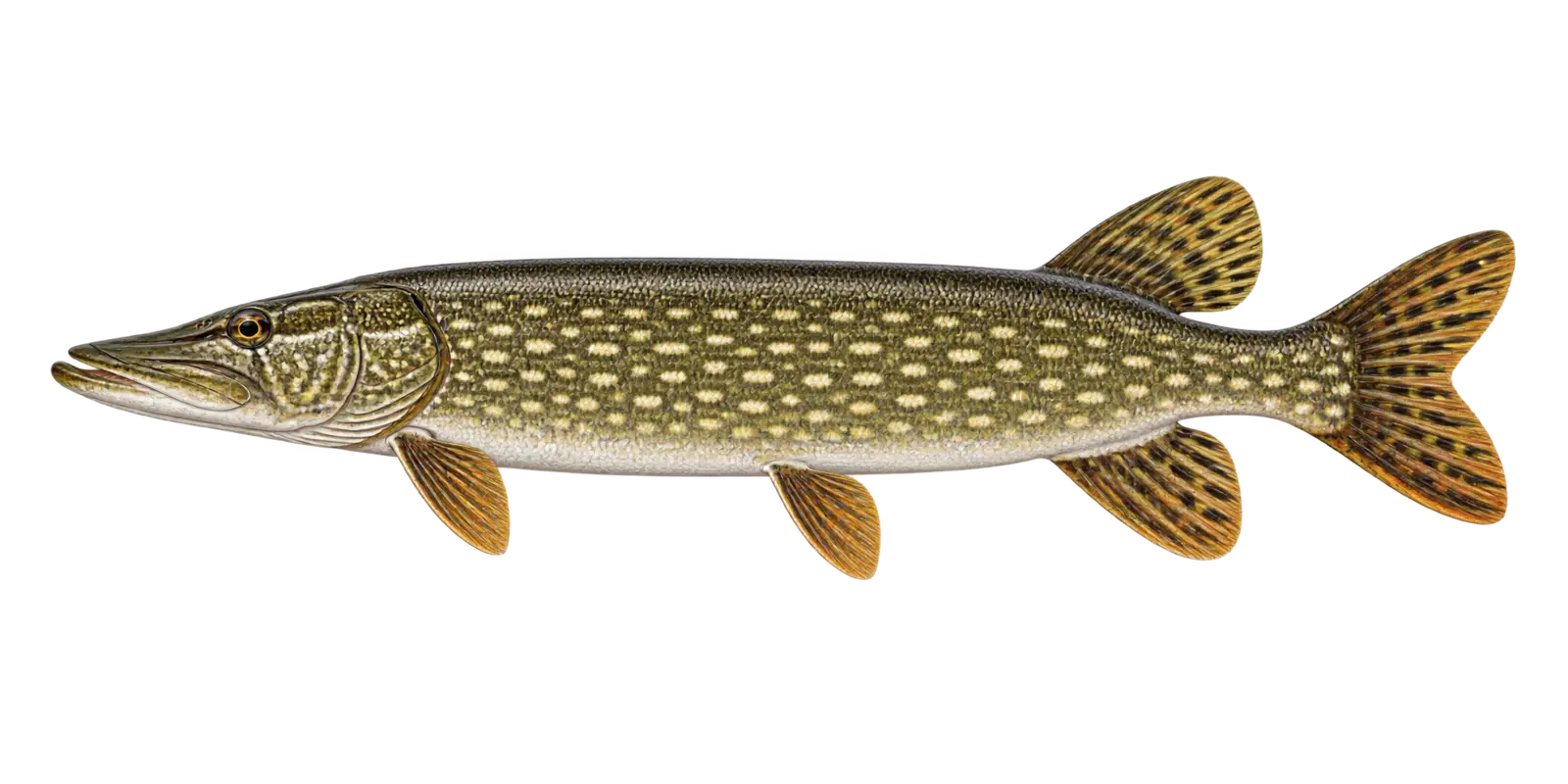 Light spots on a dark body
Primary predator
Northern Pike
Esox lucius
- Spring
- Fall
- Winter
In particular, consider Northern Pike in Upper Red Lake’s enormous 15-foot-deep basin. Within Red Lake, northern pike are fast ambush predators that may use shallow vegetation, breaklines, points, and deeper structure as conditions change.
How to recognize it
For example, use these marks for an Upper Red Lake field check. On Red Lake, look for a long torpedo body, a broad duckbill snout, pale bean-shaped spots on darker green sides, and a dorsal fin near the tail.
Red Lake survey snapshot
The July 2025 DNR report described strong northern pike size potential. However, that survey context is not a guarantee about the size of fish on a particular trip.
Where it fits here
Meanwhile, in Upper Red Lake, shoreline influence, river mouths, remaining vegetation, and basin forage give predators subtle travel references.
Often confused with
By contrast, compare these marks before assigning an Upper Red Lake species name. On Red Lake, muskellunge usually show dark markings on a lighter body. Around Red Lake, northern pike show lighter spots on a darker body.
Starting depth zone
Vegetation, breaks, and deeper structureA flexible zone, not an exact fishing location.
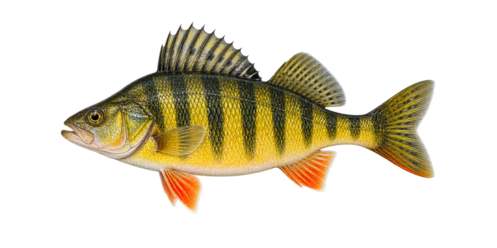 Dark bars and orange lower fins
Panfish and forage
Yellow Perch
Perca flavescens
- Spring
- Fall
- Winter
In particular, consider Yellow Perch in Upper Red Lake’s enormous 15-foot-deep basin. Within Red Lake, yellow perch are both an angling opportunity and an important prey fish that may gather in schools over flats and along edges.
How to recognize it
For example, use these marks for an Upper Red Lake field check. On Red Lake, the golden-yellow body, six to eight dark vertical bars, orange lower fins, and two separate dorsal fins are easy field marks.
Red Lake survey snapshot
The 2025 large-lake report described improving opportunities for larger yellow perch as the population changed.
Where it fits here
Meanwhile, in Upper Red Lake, subtle bottom changes and basin forage let schools roam without following a dramatic contour.
Often confused with
By contrast, compare these marks before assigning an Upper Red Lake species name. On Red Lake, young walleye are less yellow, show different mottling, and have the characteristic white lower tail tip.
Starting depth zone
Flats, weed edges, and basin transitionsPerch can roam from shallow water to deeper schools.
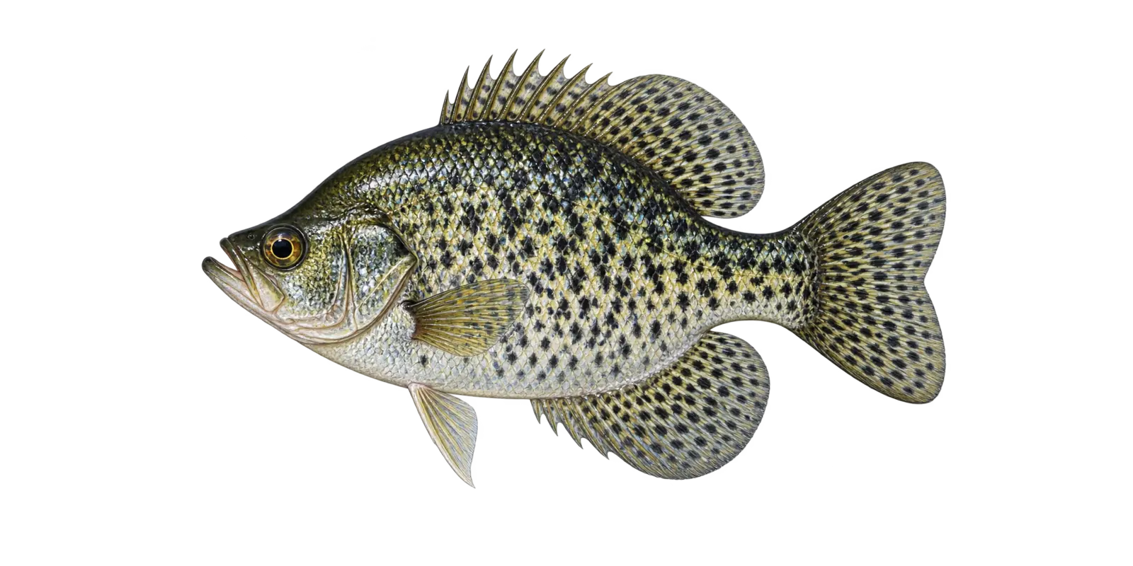 Irregular black mottling
Panfish
Black Crappie
Pomoxis nigromaculatus
- Spring
- Summer
- Winter
In particular, consider Black Crappie in Upper Red Lake’s enormous 15-foot-deep basin. Within Red Lake, black crappie often travel in loose schools and may hold around vegetation, wood, or suspended over deeper water.
How to recognize it
For example, use these marks for an Upper Red Lake field check. On Red Lake, look for a deep compressed body covered with irregular black blotches, a slightly upturned mouth, and seven or eight dorsal spines.
Red Lake survey snapshot
The 2025 DNR narrative noted occasional black crappie opportunities. Crappie can be locally important even when they are not the main focus of broad large-lake sampling.
Where it fits here
Meanwhile, in Upper Red Lake, localized cover, protected shoreline water, and compact schools matter more than a classic steep break.
Often confused with
By contrast, compare these marks before assigning an Upper Red Lake species name. On Red Lake, white crappie usually show organized vertical bars and have fewer dorsal spines. Around Red Lake, black crappie look more randomly mottled.
Starting depth zone
Cover, weed edges, and suspended schoolsCrappie depth can change quickly during the day.
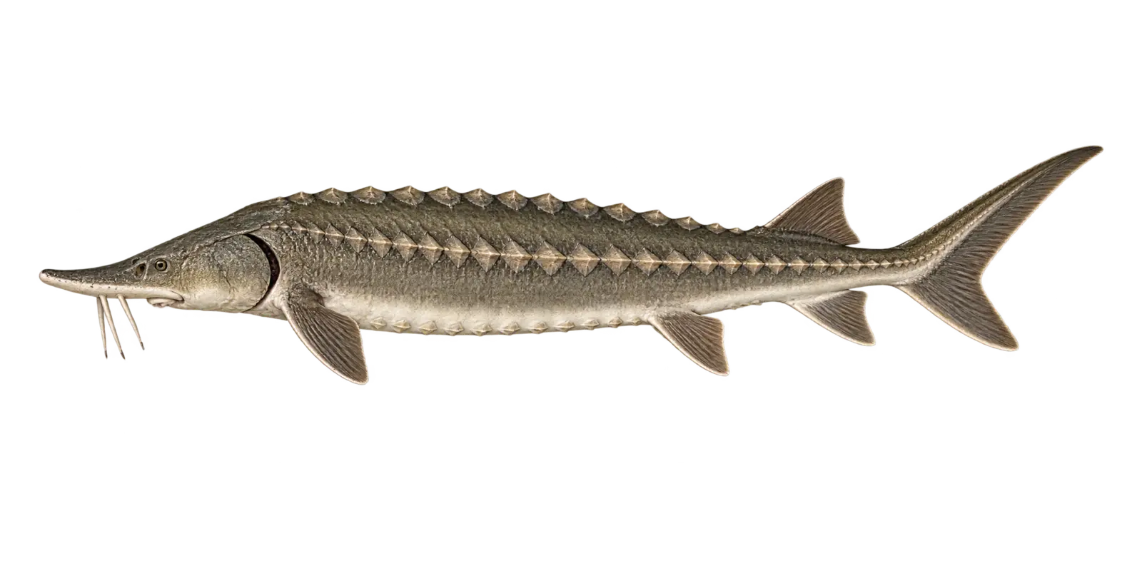 Five rows of bony plates and four barbels
Ancient native giant
Lake Sturgeon
Acipenser fulvescens
- Spring movement
- Summer
- Fall
In particular, consider Lake Sturgeon in Upper Red Lake’s enormous 15-foot-deep basin. Within Red Lake, lake sturgeon are long-lived native fish that feed along the bottom and can move widely through large lake and river systems.
How to recognize it
For example, use these marks for an Upper Red Lake field check. On Red Lake, look for five rows of hard bony plates, four barbels ahead of a protrusible mouth, a pointed snout, and a shark-like tail.
Red Lake survey snapshot
Minnesota DNR LakeFinder lists Lake Sturgeon in Upper Red Lake. However, the available survey tables do not support a recent species-specific size statement for this Upper Red Lake page.
Where it fits here
Meanwhile, in Upper Red Lake, tributary connections, current, and open-basin travel link the lake to a broader river-lake system.
Often confused with
By contrast, compare these marks before assigning an Upper Red Lake species name. On Red Lake, suckers have ordinary scales and no rows of bony plates. Around Red Lake, a young sturgeon still shows the armored body and distinctive tail.
Starting depth zone
Channels, holes, current edges, and bottom flatsThese fish may move widely through connected waters.
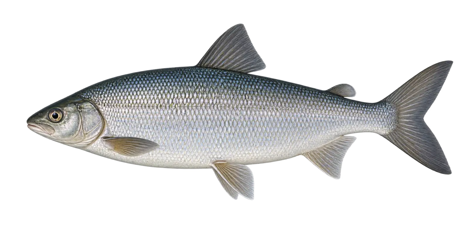 Overhanging snout and small lower mouth
Cold-water native fish
Lake Whitefish
Coregonus clupeaformis
- Summer deep water
- Fall spawning
- Winter
In particular, consider Lake Whitefish in Upper Red Lake’s enormous 15-foot-deep basin. Within Red Lake, lake whitefish connect cold-water habitat to the broader food web and are important culturally and ecologically across northern Minnesota.
How to recognize it
For example, use these marks for an Upper Red Lake field check. On Red Lake, look for a bright silver body, an adipose fin, an overhanging snout, and a small mouth positioned beneath the snout.
Red Lake survey snapshot
The 2025 DNR sampling measured 62 Lake Whitefish from 2 to 3 inches. However, those sampled Upper Red Lake fish are a survey snapshot rather than a current population count.
Where it fits here
Meanwhile, in Upper Red Lake, cool-season basin water, river influence, and bottom areas matter because the lake has no deep summer refuge.
Often confused with
By contrast, compare these marks before assigning an Upper Red Lake species name. On Red Lake, cisco have a more forward lower jaw and a smaller, more delicate body. Around Red Lake, whitefish show the stronger overhanging snout.
Starting depth zone
Cool basin edges and deeper bottom waterCold, oxygenated water is the key relationship.
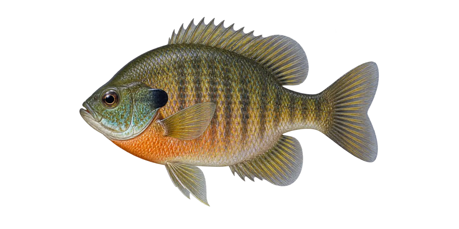 Dark ear flap and small mouth
Panfish
Bluegill
Lepomis macrochirus
- Spring
- Summer
- Winter
In particular, consider Bluegill in Upper Red Lake’s enormous 15-foot-deep basin. Within Red Lake, bluegill are one of the easiest fish for a new angler to recognize and often relate to vegetation, protected shoreline, and nearby cover.
How to recognize it
For example, use these marks for an Upper Red Lake field check. On Red Lake, look for a deep round body, a small mouth, blue-green color on the cheek and throat, faint vertical bars, and a solid dark ear flap.
Red Lake survey snapshot
The 2024 DNR sampling documented 3 Bluegill in survey seining. However, a Upper Red Lake gear-specific catch should not be treated as a full population estimate.
Where it fits here
Meanwhile, in Upper Red Lake, localized cover, protected shoreline water, and compact schools matter more than a classic steep break.
Often confused with
By contrast, compare these marks before assigning an Upper Red Lake species name. On Red Lake, pumpkinseed have bright blue facial lines and a red-orange crescent on the rear edge of the ear flap.
Starting depth zone
Shallow weeds, cover, and nearby edgesSchools can shift deeper during bright or warm periods.
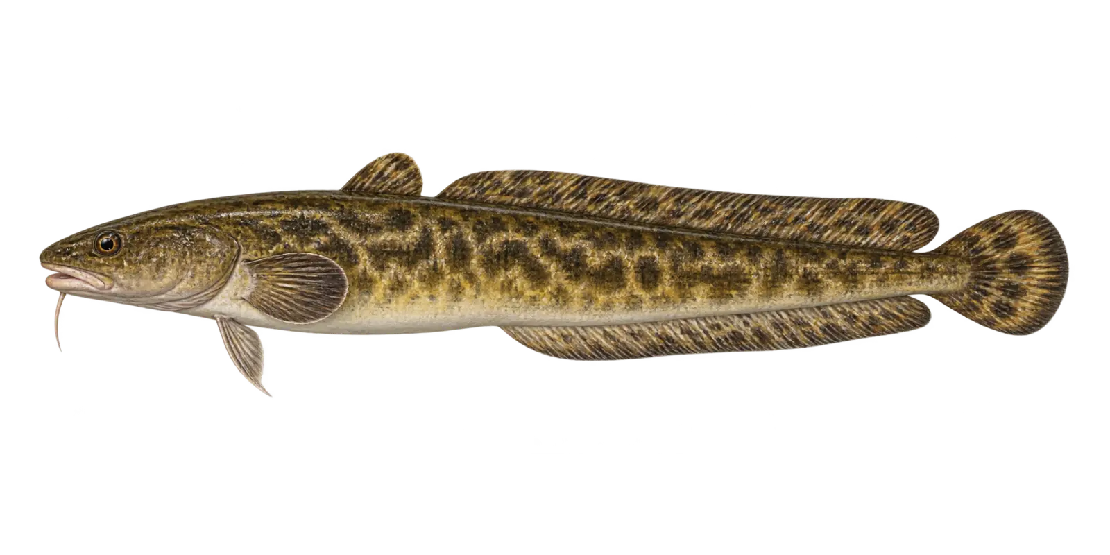 Chin barbel and eel-like body
Cold-water predator
Burbot
Lota lota
- Winter
- Early spring
In particular, consider Burbot in Upper Red Lake’s enormous 15-foot-deep basin. Within Red Lake, burbot are the only freshwater member of the cod family in Minnesota and are especially active in cold water.
How to recognize it
For example, use these marks for an Upper Red Lake field check. On Red Lake, look for an eel-like mottled body, one barbel under the chin, two dorsal fins, and a rounded tail.
Red Lake survey snapshot
The 2024 DNR sampling measured 2 Burbot from 9 to 19 inches. However, those sampled Upper Red Lake fish are a survey snapshot rather than a current population count.
Where it fits here
Meanwhile, in Upper Red Lake, cool-season basin water, river influence, and bottom areas matter because the lake has no deep summer refuge.
Often confused with
By contrast, compare these marks before assigning an Upper Red Lake species name. On Red Lake, bowfin have no chin barbel and one long continuous dorsal fin. Around Red Lake, burbot have two distinct dorsal fins.
Starting depth zone
Cool bottom water and winter spawning routesCold water is the strongest habitat clue.
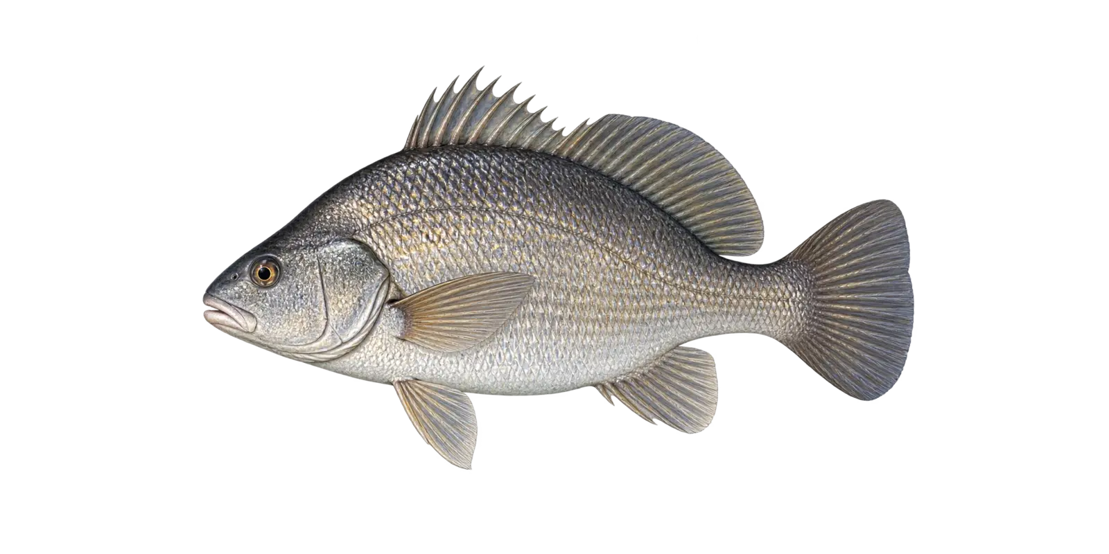 High back and long dorsal fin
Large native rough fish
Freshwater Drum
Aplodinotus grunniens
- Spring
- Summer
- Fall
In particular, consider Freshwater Drum in Upper Red Lake’s enormous 15-foot-deep basin. Within Red Lake, freshwater drum are strong native fish that feed on insects, mussels, crayfish, and small fish across large lakes and connected waters.
How to recognize it
For example, use these marks for an Upper Red Lake field check. On Red Lake, look for a deep silvery body, a high arched back, a blunt snout, and a long dorsal fin divided into spiny and soft sections.
Red Lake survey snapshot
The 2025 DNR sampling measured 28 Freshwater Drum from 12 to 17 inches. However, those sampled Upper Red Lake fish are a survey snapshot rather than a current population count.
Where it fits here
Meanwhile, in Upper Red Lake, mud, sand, river influence, and slight bottom changes spread feeding habitat across the shallow basin.
Often confused with
By contrast, compare these marks before assigning an Upper Red Lake species name. On Red Lake, white bass show horizontal stripes and a clearly forked tail. Around Red Lake, freshwater drum lack those stripes and have a more rounded tail.
Starting depth zone
Flats, channel edges, and basin transitionsA bottom-oriented fish across a broad depth range.
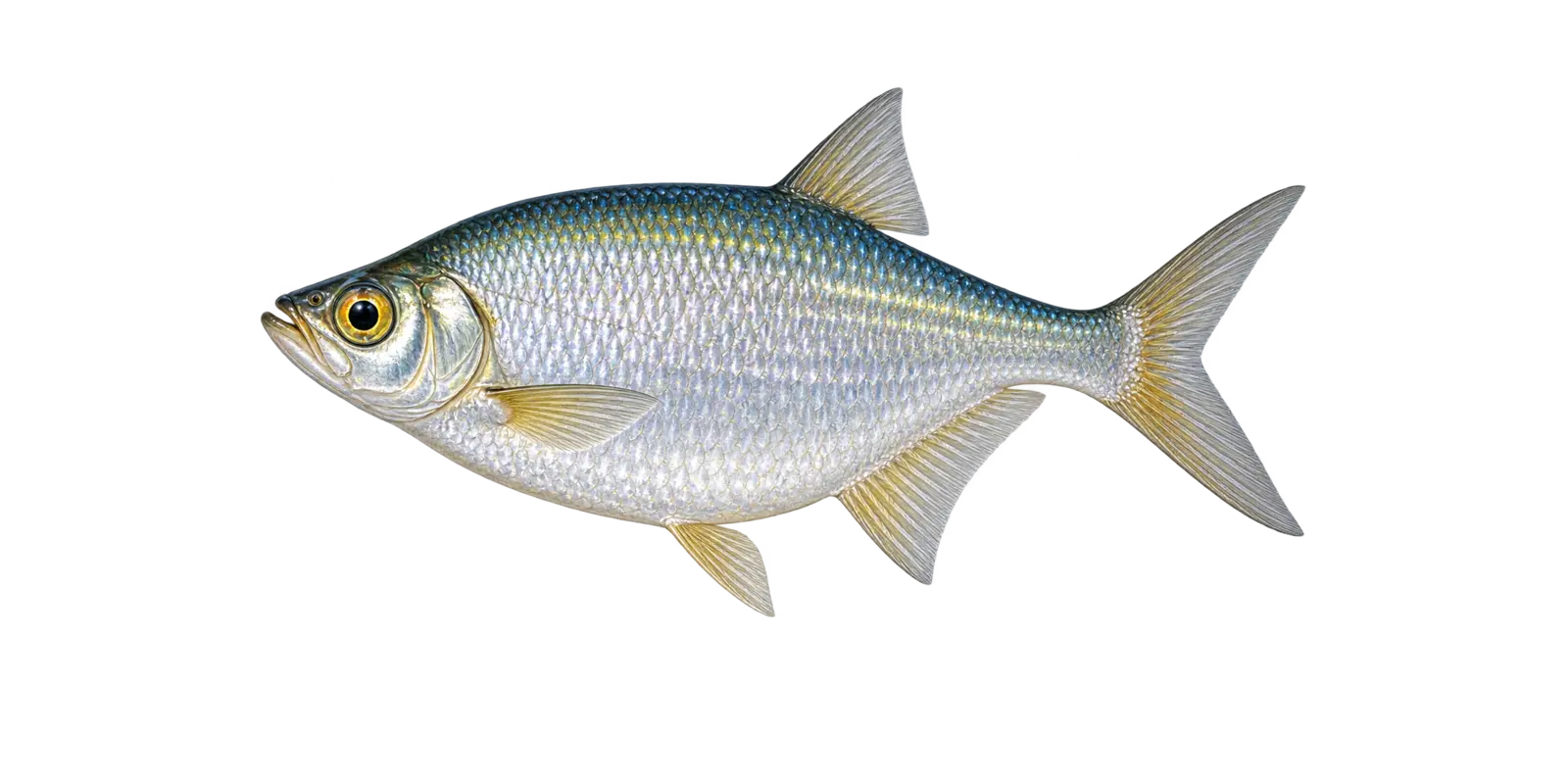 Large golden eye and deep silver body
Open-water native fish
Goldeye
Hiodon alosoides
- Spring
- Summer
- Fall
In particular, consider Goldeye in Upper Red Lake’s enormous 15-foot-deep basin. Within Red Lake, goldeye are silvery open-water fish that feed on insects, crustaceans, and small fish in large lakes and connected rivers.
How to recognize it
For example, use these marks for an Upper Red Lake field check. On Red Lake, the oversized gold-colored eye, toothed mouth, deep compressed body, and sharp belly edge are important clues.
Red Lake survey snapshot
Minnesota DNR LakeFinder lists Goldeye in Upper Red Lake. However, the latest broad survey summary for Upper Red Lake does not provide a dependable species-specific size estimate for this listing.
Where it fits here
Meanwhile, in Upper Red Lake, tributary connections, current, and open-basin travel link the lake to a broader river-lake system.
Often confused with
By contrast, compare these marks before assigning an Upper Red Lake species name. On Red Lake, mooneye are closely related and very similar. Around Red Lake, body proportions and fin position are often needed to separate them reliably.
Starting depth zone
Open water and connected current zonesA mobile fish that is not tied to one depth.
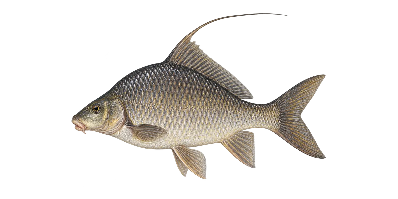 Long first dorsal ray and deep body
Native bottom feeder
Quillback
Carpiodes cyprinus
- Spring movement
- Summer
- Fall
In particular, consider Quillback in Upper Red Lake’s enormous 15-foot-deep basin. Within Red Lake, quillback are native members of the sucker family that feed on small bottom organisms and organic material.
How to recognize it
For example, use these marks for an Upper Red Lake field check. On Red Lake, look for a very deep compressed silver body, a small underslung mouth, and a long threadlike first ray on the dorsal fin.
Red Lake survey snapshot
Minnesota DNR LakeFinder lists Quillback in Upper Red Lake. However, the latest broad survey summary for Upper Red Lake does not provide a dependable species-specific size estimate for this listing.
Where it fits here
Meanwhile, in Upper Red Lake, mud, sand, river influence, and slight bottom changes spread feeding habitat across the shallow basin.
Often confused with
By contrast, compare these marks before assigning an Upper Red Lake species name. On Red Lake, other carpsuckers have a shorter dorsal extension. Around Red Lake, the quillback’s long first dorsal ray is the strongest clue.
Starting depth zone
Broad flats and bottom transitionsA bottom-oriented fish in large connected waters.
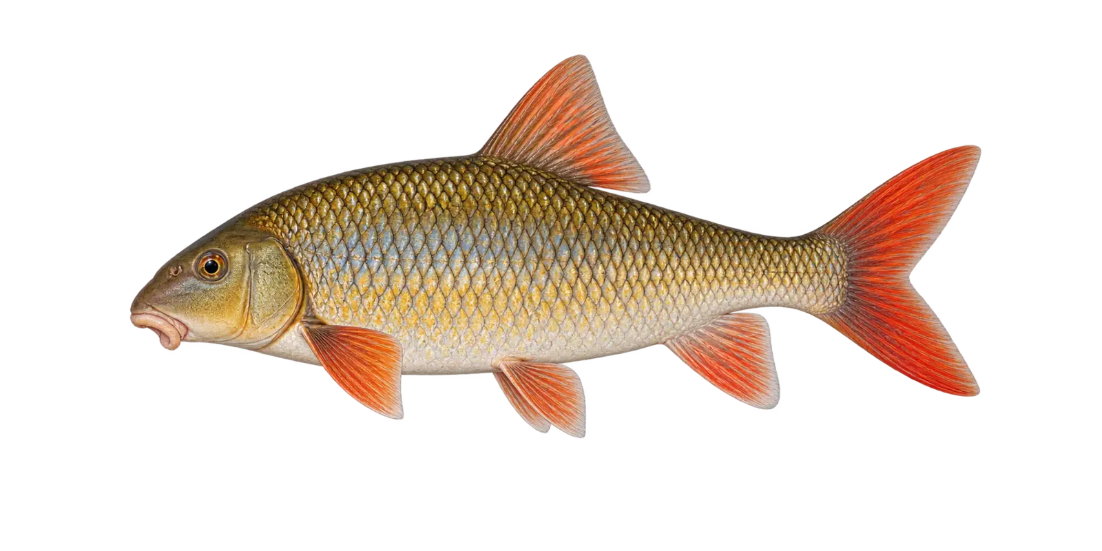 Representative shorthead redhorse illustration
General LakeFinder listing
Redhorse
Moxostoma species
- Spring movement
- Summer
- Fall
In particular, consider Redhorse in Upper Red Lake’s enormous 15-foot-deep basin. Within Red Lake, the LakeFinder record uses the general label Redhorse. Across Red Lake, these native suckers feed on small organisms along the bottom.
How to recognize it
For example, use these marks for an Upper Red Lake field check. On Red Lake, redhorse have a fleshy mouth beneath the snout, large scales, and often show orange to red color in the lower fins.
Red Lake survey snapshot
Minnesota DNR LakeFinder lists Redhorse in Upper Red Lake. However, the latest broad survey summary for Upper Red Lake does not provide a dependable species-specific size estimate for this listing.
Where it fits here
Meanwhile, in Upper Red Lake, mud, sand, river influence, and slight bottom changes spread feeding habitat across the shallow basin.
Often confused with
By contrast, compare these marks before assigning an Upper Red Lake species name. On Red Lake, redhorse species can be difficult to separate from one another. Around Red Lake, lip shape, head proportions, and scale counts may be required.
Starting depth zone
Firm bottom and connected-water transitionsThe DNR listing does not identify the redhorse species.
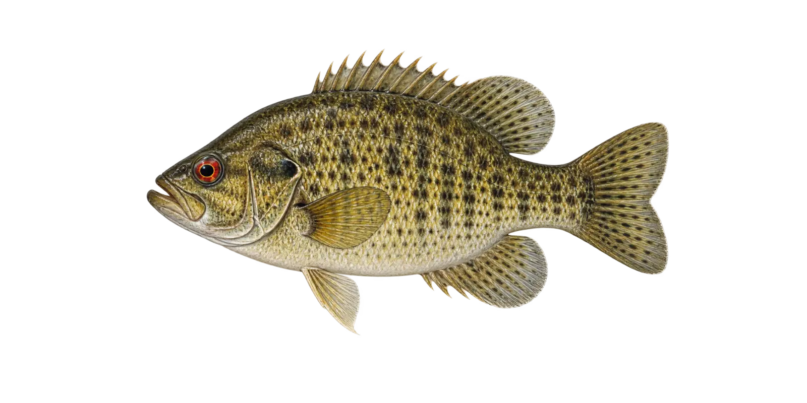 Red eye and mottled body
Cover-oriented panfish
Rock Bass
Ambloplites rupestris
- Spring
- Summer
- Fall
In particular, consider Rock Bass in Upper Red Lake’s enormous 15-foot-deep basin. Within Red Lake, rock bass are sturdy cover fish with a large mouth. Across Red Lake, rock, wood, shade, and firm shoreline edges are useful habitat clues.
How to recognize it
For example, use these marks for an Upper Red Lake field check. On Red Lake, a deep red-orange eye, olive-bronze mottling, a stout body, and a mouth larger than most sunfish are the quickest clues.
Red Lake survey snapshot
The 2024 DNR sampling measured 1 Rock Bass at 7 inches. However, that limited Upper Red Lake measurement does not describe the lake’s full size range.
Where it fits here
Meanwhile, in Upper Red Lake, localized cover, protected shoreline water, and compact schools matter more than a classic steep break.
Often confused with
By contrast, compare these marks before assigning an Upper Red Lake species name. On Red Lake, crappie have a thinner profile. Around Red Lake, smallmouth bass are more elongated and lack the classic rock bass body shape.
Starting depth zone
Rock, wood, and firm edgesCover is usually the more useful clue.
Short head and red-orange lower finsNative redhorse
Shorthead Redhorse
Moxostoma macrolepidotum
- Spring movement
- Summer
- Fall
In particular, consider Shorthead Redhorse in Upper Red Lake’s enormous 15-foot-deep basin. Within Red Lake, shorthead redhorse are native bottom feeders that use a fleshy sucker mouth to collect insects and other food from the substrate.
How to recognize it
For example, use these marks for an Upper Red Lake field check. On Red Lake, look for a relatively short head, a silver-bronze body, large scales, and orange to red color in the lower fins and tail.
Red Lake survey snapshot
The 2022 DNR sampling documented 5 Shorthead Redhorse in survey seining. However, a Upper Red Lake gear-specific catch should not be treated as a full population estimate.
Where it fits here
Meanwhile, in Upper Red Lake, mud, sand, river influence, and slight bottom changes spread feeding habitat across the shallow basin.
Often confused with
By contrast, compare these marks before assigning an Upper Red Lake species name. On Red Lake, other redhorse species are very similar. Around Red Lake, lip shape, head proportions, and scale counts may be needed for certainty.
Starting depth zone
Firm bottom, gravel, and connected-water habitatBottom type often matters more than exact depth.
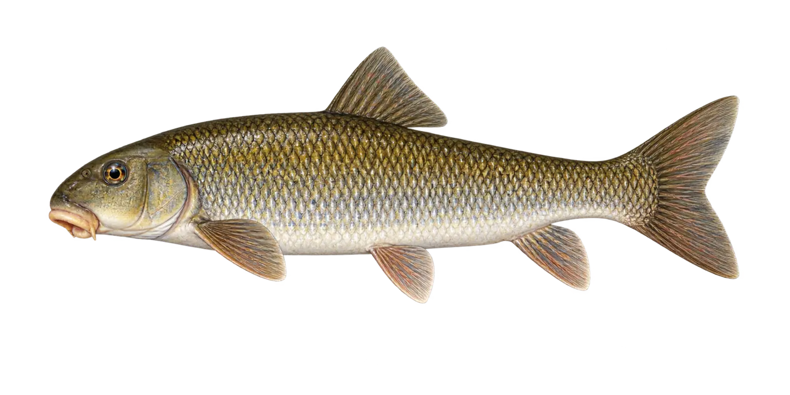 Downturned sucker mouth
Native bottom feeder
White Sucker
Catostomus commersonii
- Spring movement
- Year-round habitat
In particular, consider White Sucker in Upper Red Lake’s enormous 15-foot-deep basin. Within Red Lake, white suckers feed along the bottom on insects, small organisms, and organic material and are a normal native part of the food web.
How to recognize it
For example, use these marks for an Upper Red Lake field check. On Red Lake, look for a blunt snout, a fleshy mouth set under the head, large obvious scales, and a long silver-bronze body without barbels.
Red Lake survey snapshot
The 2025 DNR sampling measured 14 White Sucker from 7 to 17 inches. However, those sampled Upper Red Lake fish are a survey snapshot rather than a current population count.
Where it fits here
Meanwhile, in Upper Red Lake, mud, sand, river influence, and slight bottom changes spread feeding habitat across the shallow basin.
Often confused with
By contrast, compare these marks before assigning an Upper Red Lake species name. On Red Lake, redhorse species often have red-orange fins and different lip shapes. Around Red Lake, carp have mouth barbels; white suckers do not.
Starting depth zone
Bottom habitat across a broad depth rangeThe lake bottom is the key relationship.
Plain-English fish glossary
- Breakline
- A place where the bottom changes depth more quickly.
- Forage fish
- A fish that is an important food source for larger predators.
- Littoral zone
- Shallower water where enough light reaches the bottom for plants to grow.
- Adipose fin
- A small fleshy fin between the main dorsal fin and tail on fish such as cisco.
- Trap net
- A passive DNR sampling net often used near shore. Its catch is not a direct count of every fish in the lake.
- Gill net
- A DNR survey net used to sample open-water fish. Results describe that sampling effort, not a current bite report.
Upper Red Lake species names, measurements, and survey notes follow Minnesota DNR LakeFinder records, while the illustrations emphasize practical field marks rather than documenting a particular catch. LakeFinder uses group-level labels for Redhorse on this Upper Red Lake record, so those panels explicitly identify the pictured fish as representative. Survey results for Upper Red Lake remain snapshots, not promises about present abundance or fishing success.
JavaScript is needed to switch the Upper Red Lake fish cards. Visitors researching Upper Red Lake can also use the Minnesota DNR fish guide at dnr.state.mn.us/fish.
DNR survey context
What the Recent Surveys Tell Us
- July 1, 2025: The July 2025 large-lake survey reported 50.9 Walleye per gill net, with young fish from the 2022 year class dominating the population. Meanwhile, the same report describes strong Northern Pike size potential and improving opportunities for larger Yellow Perch and occasional Black Crappie.
- In addition, the DNR narrative describes roughly 60% of the lake under Red Lake Band jurisdiction and 40% under Minnesota jurisdiction.
- Notably, Walleye regulations are adjusted frequently under the cooperative management plan.
- Finally, the collected LakeFinder record had no contour PDF, so this guide uses an original shallow-basin profile and a live chart link.
Read the complete Upper Red Lake Minnesota DNR survey record
Seasonal starting points
Red Lake Fishing Guide by Season
Use these Upper Red Lake patterns as a starting framework rather than a promise about one day. On Upper Red Lake, water temperature, wind, forage movement, and recent weather should determine the final location and presentation.
Spring
River influence, warming shoreline, spawning recovery, and subtle bottom changes shape the early open-water fishery. Verify the current walleye season and Minnesota boundary before launching.
Summer
Wind, water color, basin forage, and small depth changes become central. Because the lake is shallow, fish can move a long distance without crossing dramatic contours.
Fall
Cooling water can renew walleye and pike activity across the basin. However, rapid weather changes and shorter daylight require a conservative travel radius.
Winter
Upper Red is a major winter destination, but resort roads, pressure ridges, cracks, snow, and jurisdiction boundaries change. Use current local information and keep checking conditions.
Plan before you launch
Red Lake Fishing Guide: Map, Access, and Official Resources
Use the original shallow-basin profile to understand why small depth changes can matter on Upper Red Lake, then open the interactive chart for a closer planning view. Confirm the current state-water boundary, access, regulations, weather, and navigation information before traveling.

Before you fish
Red Lake Fishing Guide: Trip Planning Notes
Use these reference points with current Minnesota DNR information when preparing for a day on Upper Red Lake.
Shallow Big-Water Scale
Upper Red covers 119,294.35 acres but reaches only 15 feet. Subtle changes and weather influence a huge area.
Jurisdiction
Roughly 60 percent is described under Red Lake Band jurisdiction and 40 percent under Minnesota jurisdiction. Know the boundary.
2025 Walleye Catch
The latest large-lake survey recorded 50.9 walleye per gill net, dominated by the 2022 year class.
Changing Regulations
Walleye regulations are adjusted frequently. Check the live official rule for the exact season and water segment.
Aquatic Invasive Species
Zebra mussels are listed. Clean, drain, dispose, and follow all bait and water-transport rules.
Wind and Distance
There is little protection across the basin. Keep the travel radius conservative and watch changes in wind direction.
Map Sources
The page pairs an original shallow-basin profile with an interactive chart because LakeFinder lacked a contour PDF. Use current navigation, boundary, access, and regulation tools for the trip itself.
Winter Routes
Ice roads and marked routes change with cracks and pressure ridges. Follow operators, carry safety gear, and continue checking ice.
Upper Red Lake catches
Red Lake Fishing Guide: See the Fishery and Plan Your Day
These photos show successful walleye trips on Upper Red Lake and the kind of group experience this broad shallow fishery can produce.

